

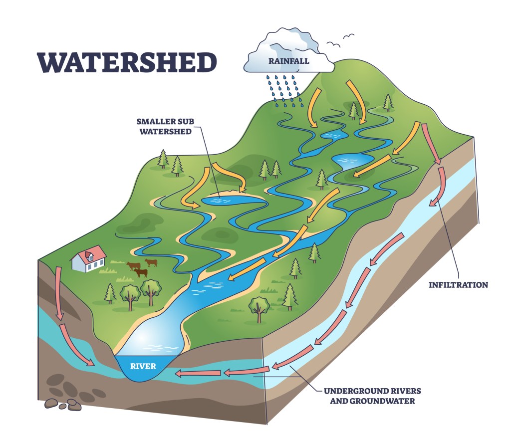
Water, the essence of life, is becoming increasingly precious. As climate change disrupts weather patterns and our population grows, the demand for this limited resource intensifies. Smart solutions are imperative, and understanding watersheds is key. A watershed is an area where all rainfall drains downhill towards a common body of water, like a river, lake, or ocean. It’s our natural water distribution system, and GIS technology is transforming our understanding and protection of it, providing remarkable insights that inspire us to conserve water more effectively.
Water conservation is more important than ever in today’s world, where demand is intensifying amidst climate change and population growth. The key to managing our water resources effectively lies in our understanding of watersheds—the fundamental building blocks of the hydrological cycle. Geographic Information Systems (GIS) technology has emerged as a pivotal tool in this endeavor, enabling precise mapping and analysis of watersheds. This article delves into how GIS is revolutionizing water conservation through sophisticated mapping and analysis, leading to informed decisions that secure our water future.
What is GIS and How Does It Help with Watershed Mapping
Geographic Information Systems (GIS) integrate various types of data to map, analyze, and visualize geographical spaces. GIS uses data such as topography, hydrography, land cover, and climate in watershed conservation to create detailed watershed models. For example, terrain models in GIS delineate watershed boundaries, which is essential for understanding water flow. This capability is essential in resource management within a watershed, especially for designing strategies to mitigate droughts and floods.
- Topography: Hills and valleys tell us where water flows and collects.
- Hydrography: Maps of rivers, streams, and lakes show the paths water takes.
- Land Cover: Forests, cities, and farms affect water absorption and runoff.
- Rainfall and Climate Data: Understanding the distribution and amount of rainfall is vital for managing water supply.
By synthesizing this data, GIS visualizes the physical and environmental landscape and acts as a predictive tool, empowering policymakers and conservationists with the insights needed to anticipate and solve complex water management challenges. This integrative approach makes GIS an indispensable asset in the stewardship of our most precious natural resource—water.
Key Applications of GIS for Water Conservation
The application of GIS extends far beyond mere mapping; it is a transformative tool enabling comprehensive water resource management. By integrating and analyzing diverse data sets, GIS facilitates not only the understanding of current water conditions but also the forecasting of future scenarios. This is a vital, proactive approach to crafting sustainable water conservation strategies. Below, we explore several pivotal ways GIS contributes to preserving this invaluable resource, focusing on identifying stress points, assessing water quality, and prioritizing conservation efforts. Each application not only showcases the versatility of GIS but also underscores its critical role in ensuring the sustainability of water resources in diverse environments.
Identifying Water Stress Hotspots
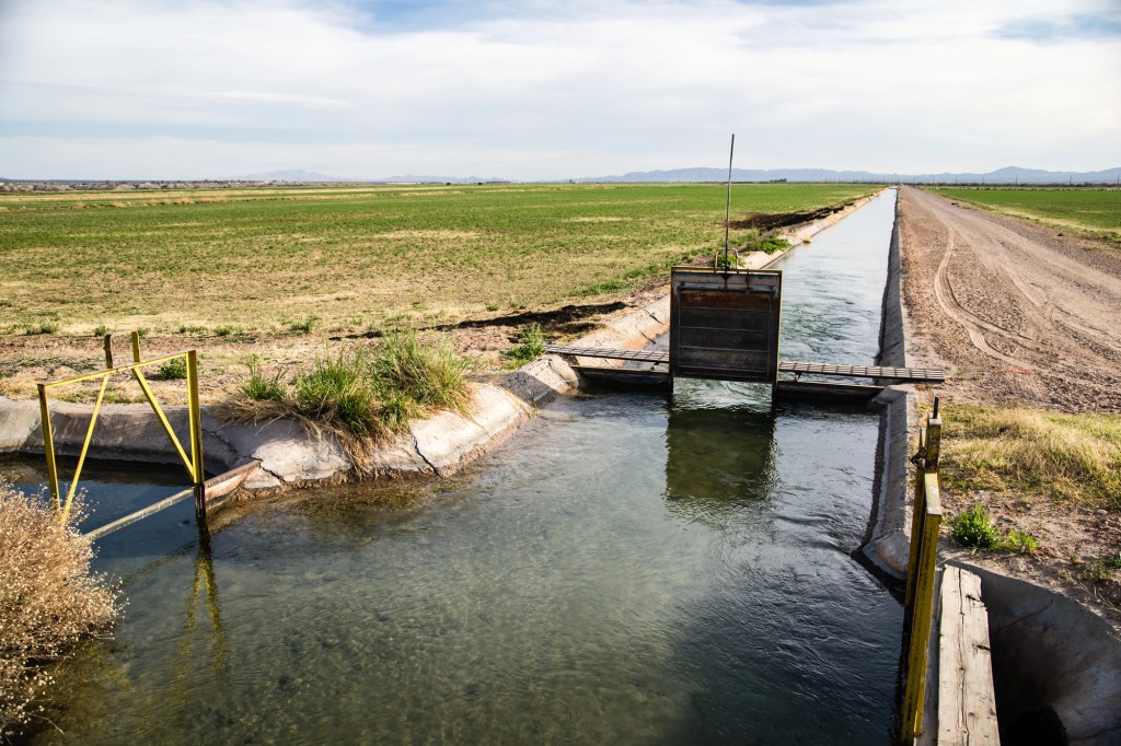
One of the most critical applications of GIS in water conservation is the identification of water stress hotspots—areas where water demand significantly exceeds supply. For example, GIS technology plays a pivotal role in California, a state frequently challenged by droughts. It helps water managers pinpoint areas like the Central Valley, where agricultural demands strain water resources. By analyzing data on water usage, rainfall patterns, and land use, GIS assists in prioritizing water allocation, planning drought responses, and designing sustainable agricultural practices that balance water use with conservation needs.
Another compelling case is the Aral Sea region in Central Asia, which has diminished to less than 10% of its original size due to the diversion of rivers for irrigation purposes. GIS mapping has been instrumental in tracking the decline of the Aral Sea and identifying regions severely impacted by water scarcity. This technology supports the implementation of conservation measures and the planning of sustainable water management strategies, highlighting the vital role of GIS in addressing global water resource challenges.

Water Quality Assessment
GIS are invaluable for assessing water quality, particularly in identifying potential sources of pollution and their impact on water bodies. For instance, GIS is used extensively along the Mississippi River to map agricultural runoff, a major contributor to nutrient pollution. By integrating data on land use, crop types, and fertilizer application rates, GIS helps pinpoint areas where runoff is most likely to occur. This enables targeted interventions such as creating buffer zones and implementing precision agriculture techniques to minimize nutrient leaching into the river.

In urban settings, GIS proves essential in managing the complexities of pollution from multiple sources. Take London, for example, where GIS has been deployed to monitor and manage water quality in the Thames River. The system maps outflows from wastewater treatment plants and stormwater drains and tracks their influence on the river’s water quality. By analyzing flow patterns and pollution concentrations, GIS enables city planners and environmental agencies to implement more effective water treatment solutions and regulatory measures, ensuring safer water for urban populations and the environment.
Prioritizing Conservation Efforts
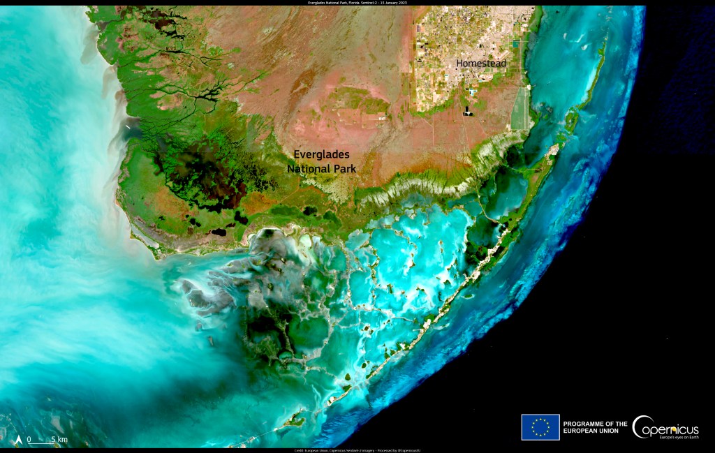
GIS are pivotal in prioritizing conservation efforts, enabling precise targeting of interventions to areas of highest ecological value or most acute restoration need. For instance, in the Florida Everglades, GIS is used in restoration projects to address water flow disruptions caused by decades of urban and agricultural development. By integrating hydrological data, vegetation patterns, and wildlife habitats, GIS tools help conservationists identify critical zones for intervention, such as areas for water flow reestablishment and invasive species management.
Similarly, GIS is instrumental in the Amazon rainforest, where deforestation severely threatens biodiversity and climate regulation. Through detailed satellite imagery and ground data, GIS applications enable the mapping of deforestation hotspots and monitoring of illegal logging activities. This data is essential for local governments and international conservation groups to focus their efforts on the most impacted areas, promoting reforestation and the protection of endangered species habitats, thereby ensuring a targeted and effective conservation strategy.
Real-World Case Studies
The theoretical advantages of GIS in water conservation are brought to life through its practical applications across the globe. These real-world examples not only demonstrate the versatility and effectiveness of GIS but also highlight its crucial role in addressing diverse and complex water-related challenges. From vast agricultural heartlands and bustling urban centers to critically endangered ecosystems, GIS technology is making a measurable difference. In this section, we delve into several case studies that showcase how GIS has been instrumental in transforming water conservation efforts, providing actionable insights, and fostering sustainable practices in different environmental and geographical settings.
Chesapeake Bay Watershed
The Chesapeake Bay, the largest estuary in the United States, faces significant environmental challenges due to pollution, habitat loss, and climate change. GIS has emerged as a vital tool in restoring and protecting this ecologically important region. The Chesapeake Bay Program, a regional partnership, utilizes GIS extensively to integrate data from multiple sources, including water quality sensors, satellite imagery, and census statistics. This comprehensive approach enables a holistic understanding of the watershed’s health and the impacts of human activity.
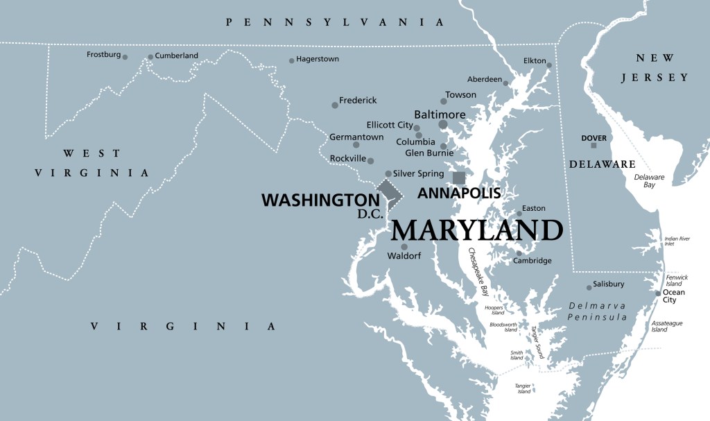
GIS mapping in the Chesapeake Bay Watershed helps identify critical areas where pollution reduction is most needed, particularly from agricultural runoff and urban stormwater. For instance, by analyzing land use patterns and overlaying them with water quality data, GIS helps pinpoint specific farms or urban areas contributing disproportionately to nutrient and sediment loads. These insights support targeted regulatory measures and conservation practices, such as buffer zone establishment, wetland restoration, and precision farming techniques.
Urban Watershed Restoration in Austin
Urban environments often pose unique challenges for watershed management due to dense development and impervious surfaces that disrupt natural water flows. Waller Creek in Austin, Texas, is a prime example of how GIS technology can drive effective urban watershed restoration efforts. Spanning approximately seven miles through the heart of Austin, Waller Creek had been heavily impacted by urban runoff, leading to water quality issues and erosion.
GIS has played a central role in the Waller Creek Watershed initiatives, a comprehensive effort to restore and revitalize this urban waterway. GIS helps city planners understand the complex dynamics of urban runoff and its effects on the creek by mapping the watershed’s topology, land use, and stormwater drainage infrastructure. This information has been instrumental in designing green infrastructure solutions tailored to specific locations along the creek. Features such as rain gardens, permeable pavements, and constructed wetlands have been strategically placed to mitigate runoff, improve water quality, and enhance the creek’s aesthetic and recreational value.
The Future of GIS in Water Conservation
Geographic Information Systems (GIS) continue to evolve, offering more sophisticated tools that promise to transform water conservation further. As we look ahead, several key advancements and integrations are set to enhance the capabilities of GIS, making it an even more essential element in managing water resources sustainably.
Advancements in Data Resolution and Real-Time Monitoring
The future of GIS lies in its ability to process and visualize data at increasingly higher resolutions and in real-time. With advancements in satellite technology and the proliferation of IoT (Internet of Things) sensors, GIS will soon be able to provide minute-by-minute updates on water conditions, such as levels, quality, and flow rates. This leap in data quality and timeliness will enable water managers to react more swiftly to changes, manage resources more effectively, and predict future water scenarios more accurately.
Integration with Emerging Technologies
Integration with other cutting-edge technologies like AI and machine learning is reshaping what GIS can do. For instance, AI can analyze vast amounts of data collected by GIS to predict trends, such as potential drought conditions or the best locations for new water conservation projects. Additionally, integrating GIS with remote sensing technologies provides a powerful tool for monitoring environmental changes over large areas and pinpointing regions that require immediate attention.
Enhancing Collaborative Water Management
As GIS technology becomes more accessible and user-friendly, it fosters greater collaboration among stakeholders in water management. Platforms combining GIS with cloud computing allow multiple users to access and interact with the same data in real-time, regardless of location. This capability is essential for coordinating large-scale water conservation efforts, such as interstate watershed management and international water resource planning. By enhancing communication and data sharing, GIS helps unify various groups towards common goals, promoting more effective and inclusive water management strategies.
Promoting Public Awareness and Engagement
GIS tools are also becoming vital in educating the public and engaging them in water conservation efforts. Interactive GIS applications allow individuals to visualize how water flows through their local environment and see firsthand the impact of their actions. This hands-on approach is invaluable for raising awareness about water conservation and motivating community involvement, which is often crucial for the success of local and regional conservation initiatives.
Taking Action
As we navigate through an era marked by climate change and increasing demands on our water resources, GIS stand at the forefront of innovative water conservation strategies. The technology’s ability to integrate, analyze, and visualize complex data has transformed our approach to managing water sustainably. GIS enhances our understanding of water systems and empowers decision-makers to implement more precise and effective conservation measures. By providing detailed insights into water dynamics, GIS helps ensure that our water management practices are proactive and responsive, safeguarding this essential resource for current and future generations.
Engagement at the local level truly makes a difference in water conservation. We encourage you to take the first step by learning more about your area’s watersheds and their specific challenges. Visit the Watershed Atlas at WatershedAtlas.org to access interactive GIS tools to help you visualize and understand your local water systems. Additionally, consider joining or supporting organizations like the River Network, which works tirelessly to protect and restore watersheds nationwide. By becoming informed and involved, you can contribute to a collective effort that promotes a sustainable water future for everyone.
Further Reading
- US Geological Survey (USGS) Water Resources – Offers a wealth of data and resources on water, including GIS datasets and mapping tools.
- EPA’s Watershed Resource Registry – A tool for effective watershed management with GIS mapping features.
- River Network – An organization dedicated to the protection and restoration of America’s rivers and watersheds.
- Aqueduct (World Resources Institute) – Provides advanced tools for mapping water risks including water stress, flooding, and drought scenarios with GIS data layers.

Leave a comment